Google Earth Track
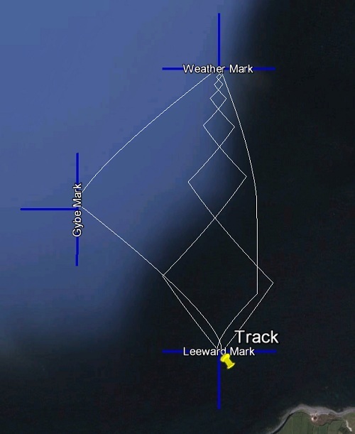
This is the output of the simulator, driving the boat around an olympic race course. The course involves the boat starting at a point directly downwind of the top mark (Weather Mark in the picture). The boat is forced to tack back and forth to reach the mark. The next waypoint is the Gybe Mark which is a broad reach down from the top (pictured on the left). From there, the boat gybes and proceeds to the Leeward Mark which is also the starting point. The boat once again beats up to the Weather Mark by tacking back and forth (note that the second upwind leg has opposing tacks to the first, which is just a coincidence). Once reaching the Weather Mark again, the boat sails directly downwind to the Leeward Mark and completes the course. The route taken was plotted on Google Earth.
Upcoming Missions
- Galway Bay Loop, Waiting for Vessel Availability